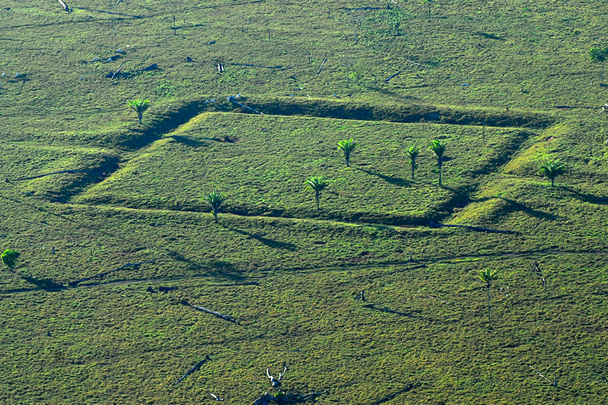

Geoglyph found on a farm in Acre state (photo: Diogo Gurgel/IPHAN)
The group uses advanced technology to map sites where vestiges of the activities of ancient populations have been preserved but risk being destroyed by the advance of deforestation, wildcat mining and climate change.
The group uses advanced technology to map sites where vestiges of the activities of ancient populations have been preserved but risk being destroyed by the advance of deforestation, wildcat mining and climate change.

Geoglyph found on a farm in Acre state (photo: Diogo Gurgel/IPHAN)
By Elton Alisson in Belém | Agência FAPESP – The discovery of thousands of archeological sites in the Amazon in recent decades has helped change how scientists view the past of the world’s largest tropical rainforest, yet these sites, where vestiges of the activities of ancient populations have been preserved, risk being destroyed by the advance of deforestation, wildcat mining (garimpo) and climate change, among other factors.
Brazilian researchers are mapping these archeological sites in partnership with communities of forest dwellers in an effort to assure their protection. To make the maps, they are using advanced technologies such as LiDAR, an airborne remote sensing system that targets objects with a laser, measures the speed and intensity of the reflected signal, and uses the data thus collected to create detailed 3D models.
Preliminary results of the project, which is called “Amazon Revealed” (Amazônia revelada), were presented during a round table session held on July 9 at the 76th Annual Meeting of the Brazilian Society for the Advancement of Science (SBPC). The conference took place on July 7-13 on the Guamá campus of the Federal University of Pará (UFPA) in Belém, the capital of Pará state, which is home to 46.8% of the population of Brazil’s North region.
“We’ll fly over the region using LiDAR to detect archeological sites and register them with bodies such as the National Historical and Artistic Heritage Institute [IPHAN] so that they’re given an additional layer of protection. At the very least, some kind of licensing should be required before any project is implemented [in the areas where the sites are located],” said Eduardo Neves, Director of the University of São Paulo’s Museum of Archeology and Ethnology (MAE-USP).
The project is funded by National Geographic and supported by Brazil’s National Space Research Institute (INPE), among other institutions. The researchers are holding talks with representatives of the communities who live in places where there is evidence of the existence of archeological sites to find out whether they want them to be mapped.
“We don’t intend to just take a plane and do the remote sensing, because that would reproduce colonialist scientific practices yet again,” Neves said.
The communities who have been consulted so far and have agreed to permit overflights include a quilombo (one of many settlements founded by fugitive enslaved people in previous centuries) in Costa Marques and the Amondawa Indigenous community in Aldeia Trincheira. Both are in Rondônia state. “The region is full of conflicts, and we have evidence of the destruction of archeological sites due to recent occupation,” Neves said.
The researchers planned to cover the Upper Xingu region but dropped the idea after talks with representatives of the Kuikuro Indigenous community. “They asked us not to fly over their land because we mean to make the information public and they don’t want other people to know all about the sites that are so important to them,” Neves said.
Instead, the researchers chose Marajó, an island in the Amazon River delta where there is evidence that manmade structures were built in the remote past. “When we looked at the digs carried out in the area, we noticed different colors indicating layers of landfills built by people who lived on Marajó in the first millennium of the Common Era, from about 400 years CE, and into the second millennium. These mounds were constructed, occupied, and served as burial grounds,” he explained.
Another area to be covered is Terra do Meio, also in Pará. The Xingu River and tributaries flow through the area, which contains conservation units and the Cachoeira Seca, Xipaya and Kuruya Indigenous reservations, as well as wildcat miners and problems relating to deforestation and timber theft.
“We’re partnering with ISA [Instituto Socioambiental], which has worked there for a long time, to map the area with participation by the community. We held workshops with the locals to decide which areas we could overfly,” Neves said.

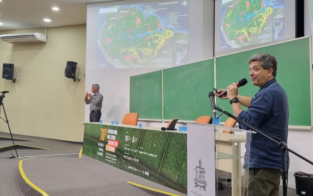
Neves delivered a presentation on his research on July 13 during the Annual Meeting of the SBPC (photo: Elton Alisson/Agência FAPESP)
First results
Last year, most of the flights they planned could not go ahead owing to the large number of forest fires in the Amazon. They began sooner this year, and the first results are already available.
An archeological site consisting of triangular and circular structures linked to highways has been detected in an area between Acre state, the south of Amazonas state and Rondônia state.
“We can now show that these geometric structures go much farther north than was previously thought. They cross the Purus River in southern Amazonas, and may go as far as the Solimões, we’ll see,” Neves said.
Another archeological site, detected in Serra da Muralha, Rondônia, comprises a stone wall and masonry structures associated with a road. Mapinguari National Park, one of Brazil’s largest conservation units, is located in the region; wildcat miners trespassed on its western extremity in 2019.
“We want to start registering these endangered archeological sites so they can be protected as national heritage monuments,” Neves said, adding that the Amazon basin contains over 6,000 registered sites and that many more must be awaiting discovery.
“We’re finding archeological sites everywhere we go in the Amazon region. The question is what to do with them.”
He went on to insist that the Amazon should be thought of not just as a natural endowment but also as a biocultural treasure that has resulted from the history of traditional communities who have lived in the region for at least 13,000 years, from Indigenous peoples to quilombolas (an inhabitant of a quilombo) and river dwellers.
“This idea of the Amazon as a historical place, not just a natural but a biocultural heritage, serves as a basis for the archeological research and has oriented our activities in the region for the last 30 years,” Neves said.
Results of previous studies conducted by Neves with FAPESP’s support can be found at: agencia.fapesp.br/51266 and agencia.fapesp.br/39627.
For more information on the 76th Annual Meeting of the SBPC (in Portuguese), visit: ra.sbpcnet.org.br/76RA/.
Republish
The Agency FAPESP licenses news via Creative Commons (CC-BY-NC-ND) so that they can be republished free of charge and in a simple way by other digital or printed vehicles. Agência FAPESP must be credited as the source of the content being republished and the name of the reporter (if any) must be attributed. Using the HMTL button below allows compliance with these rules, detailed in Digital Republishing Policy FAPESP.


